Methodology
Step 4. Limit the number of divided political units as electoral districts are formed. At the same time, measure district compactness.
This reduces the discretion of would-be gerrymanderers to “crack” or “pack” far-flung groups of opposing voters into districts that reduce their political representation.

Many different splits can accomplish necessary population adjustments. We offer two primary considerations sometimes in conflict but often complementary – 1) minimizing splits; and 2) remaining careful about compactness by using layering to add or remove political subdivisions:
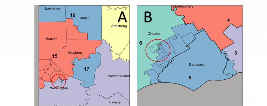
A In District 15, the combination of Beaver County and the part of Allegheny County excluded from District 17 fall short of the population target. The earlier step of Including some parts of Butler County to District 15 to equalize the District 16 population is not enough. Among the many ways to bring District 15 into population compliance, this map adds parts of Washington County, layered to retain, even improve, its compactness by including several census blocks in Chartiers Township, Voting District 02 (circled).
B Additions from Chester County to Delaware County and the residual portion of Philadelphia County bring the District 5 population into compliance. The additions include several municipalities plus whole voting districts in West Goshen Township (circled) and a few of its census blocks in North Voting Districts 02 and 03.
%20(2).jpg)